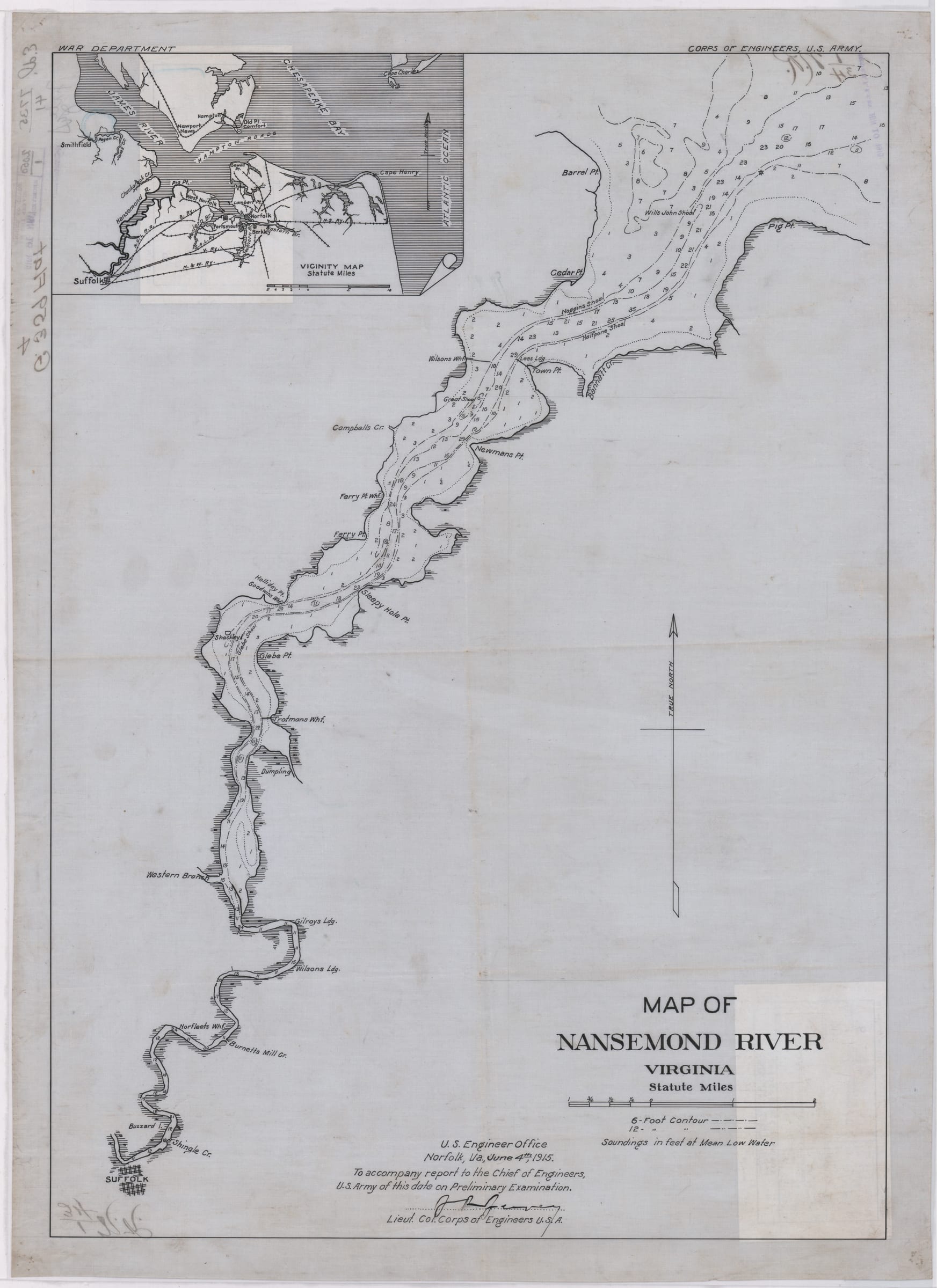
Map of Nansemond River, Virginia
 🔍 Click to zoom
This 1915 nautical chart by the U.S. Army Corps of Engineers depicts the Nansemond River in Virginia, from its mouth at Hampton Roads to the city of Suffolk. The map provides detailed soundings in feet at mean low water, indicating depths for navigation. A small inset map shows the river's location relative to the Chesapeake Bay and James River.
Sign in to download — free with any account.
Cite this map
Cites the Temple Seven copy you're viewingUnited States Army Corps of Engineers. Map of Nansemond River, Virginia. June 4th, 1915. Map. Temple Seven Press, https://qa.templeseven.com/maps/map-of-nansemond-river-virginia-local-identifier-g359-4-1915.
The same citation travels with anything you pin from this map — one source of truth.Citations are auto-generated and may be incomplete or incorrect. Double-check every citation against your style guide before submitting — you use them at your own discretion.+ Pin to an investigation